
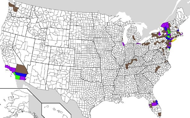
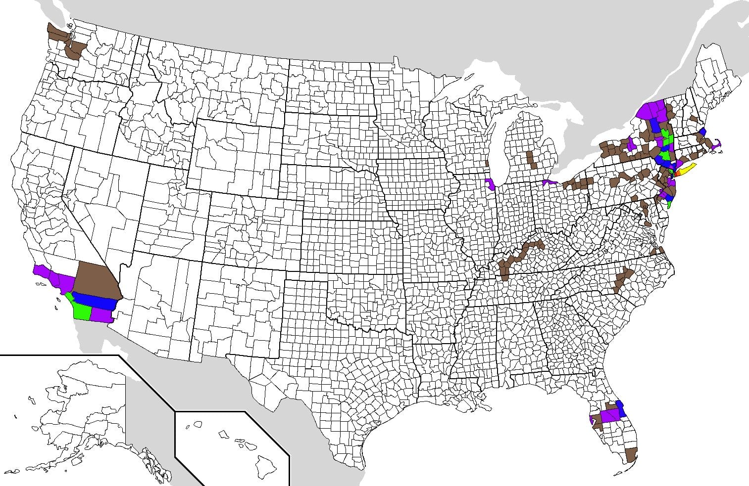
This is a very quick post to show what can be done when you are an eBird obsessive with a bit of spare time on your hands. Yes, I took the time to look at my county totals for every county that I have ever eBirded and used a map I found on Wikipedia to color code my counties according to how many species I have seen in each. I used the following color codes:
300+ species – Red
250 – 299 – Orange
200 – 249 – Yellow
150 – 199 – Green
100 – 149 – Blue
50 – 99 Purple
1 – 49 Brown
Below is a version you can click on to get a larger image. You know, if you are really, really, bored.
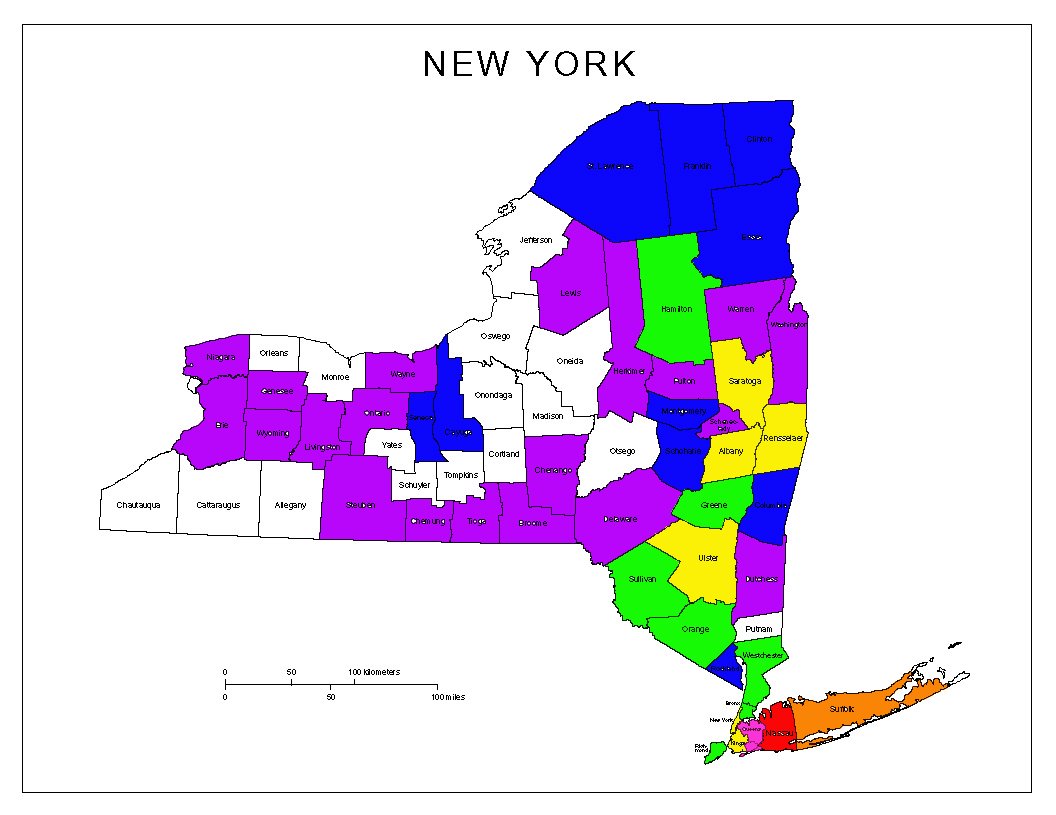
I need to go birding in more counties! To make myself feel better, here is a similar map showing just the counties in New York State. The color codes are different though: Pink is 300+, Red is 250-299, Orange is 200-249, Yellow is 150-199, Green is 100-149, Blue is 50-99, and Purple is under 50. You can click on it for a bigger version.
Do you have similar maps made? Feel free to share links in the comments!


Very nice! Can you share how you did this? I wouldn’t mind doing this for my own data.
Sure, Nick!
I found the map by searching for “United States county map” on Google. I then downloaded it, opened it in Photoshop Elements, and converted it to a jpg.
Then I opened up “My eBird” on the county level and started filling in counties using the fill tool. When I didn’t know which little tiny chunk of a state was which county I just searched for, for example, “Kentucky county map.”
The whole thing only took a couple of hours, though I don’t have that many counties to fill in…
Made mine but I still have too much data not in ebird so I have mostly brown clusters.
If I find the time, I’ll have a go at scripting this. Anyone want to help creating a list of points for every county?
Got as far as figuring out how to script the fill tool in Acorn, but Andrew Core just posted openheatmap on Facebook and that already does it. Just throw your data in a spreadsheet and pass it on.
Awesomely nerdy idea, and openheatmap worked well for me. I haven’t always kept good records, so my map is pretty sparse – still, cool to see.
Thanks for sharing the openheatmap link. I’ve been trying to figure out an easy way to get a graphical display of current county lists for quite some time. This way takes less than 5 minutes! Here’s my county totals: http://www.openheatmap.com/view.html?map=DemariaHullersMicroseismometer
Is there anything similar for countries of the world? I’ve kept a lot better track of what I have seen in various countries than I have in all the counties in the U.S.
Hi John – you can use the same openheatmap tool to map countries as well: http://www.openheatmap.com/locationhelp.php#country